MAPS Atlas is the software we built in our office for our own projects. In one environment we process point clouds from drone LiDAR and laser scanners, terrain models, orthophotos, scanned drawings and Cadastre data, and we produce CAD-ready deliverables in GGRS87 or in the coordinate system the project requires.
A 38-second presentation with real data from our projects: Agrafa, Veria, Skyros.
50+tools, from the point cloud to the DXF
Worldwidecoordinate systems for any country, with the official Greek, Cypriot, Serbian and Romanian ones built in
Millionsof points per cloud, in 3D, and many clouds together
In houseyour project data is never uploaded to third parties
From the field to the deliverable
Every project goes through the same five steps. The equipment is our own and processing takes place in our office, with the same software for the whole team.
Field capture
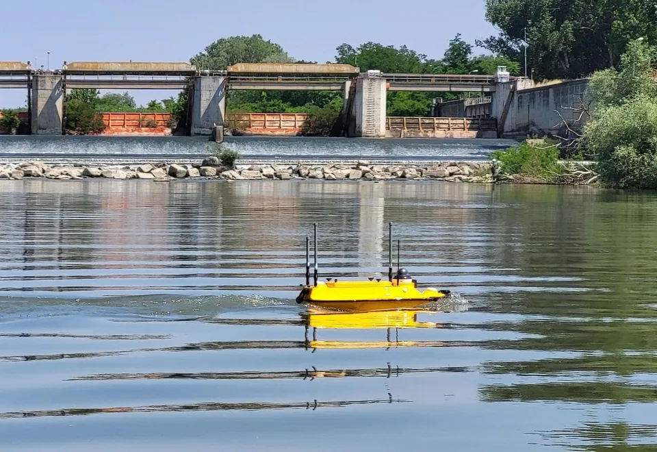
Drones with L2 LiDAR and P1 camera, FARO and NavVis scanners, a bathymetric survey boat, GNSS, total stations, digital level.
Processing of observations
Static GNSS baselines with HEPOS, traverses and networks by least squares, transformation to GGRS87 with the official grids.
Data processing
Point cloud cleaning and classification, terrain models, orthophotos, sections and drafting in MAPS Atlas.
Quality control
Check points with an accuracy report to ASPRS (RMSE), comparison with earlier surveys.
Delivery
Scaled drawings as PDF with title block, DWG/DXF with our symbol library, LAZ, GeoTIFF, ECW.
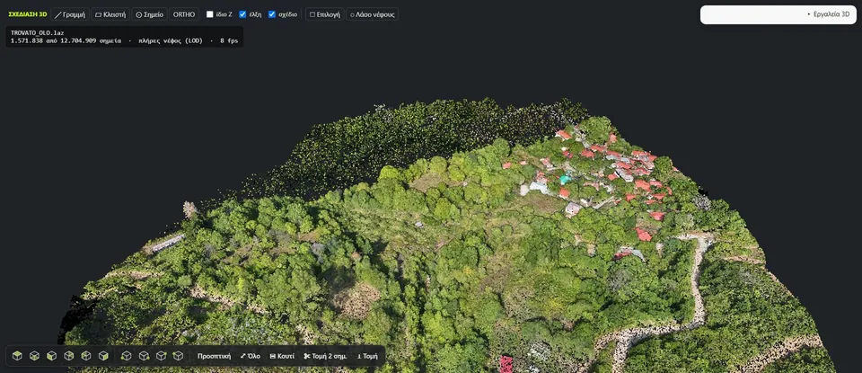
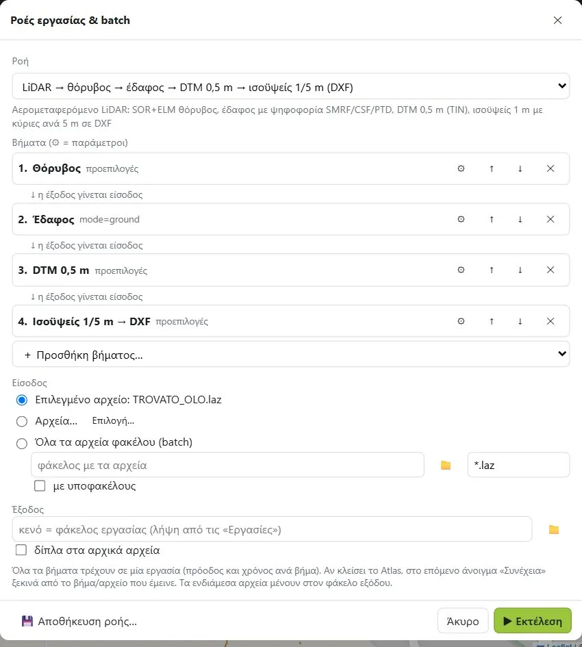
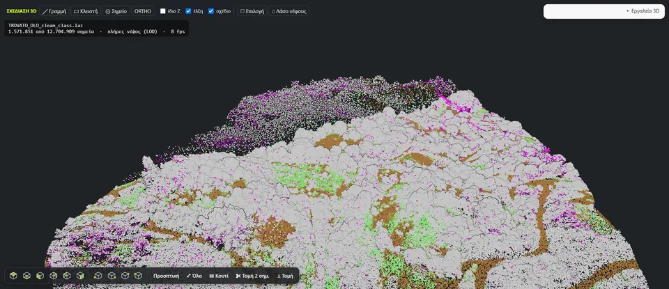
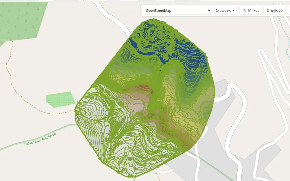
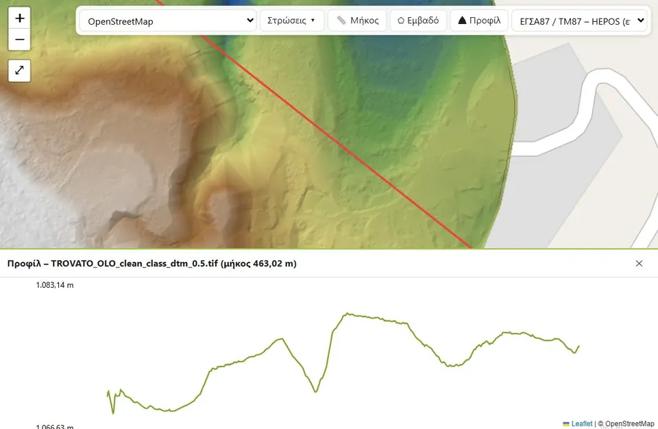
1 · Point cloudThe village and the stream from drone LiDAR: 12.7 million points in their true colour.2 · One-click workflowNoise, ground, DTM and contours in a single task, with progress for each step.3 · ClassificationGround, vegetation and buildings, with three algorithms voting on the ground.4 · DTM and contoursA 0.5 m terrain model under the forest and 1 m contours in DXF.5 · ProfilesProfiles and sections straight from the model, for the stream demarcation.
What we do for each type of project
Typical workflows: the equipment we use in the field, what we do in MAPS Atlas and what we deliver to you. We plan every project together with you.
Buildings, façades and interiors
In the field
NavVis MLX for the interiors, FARO S70 for the façades, a drone for the roofs and a total station to tie everything to GGRS87.
In MAPS Atlas
Cleaning of reflections from mirrors and glass, merging of all point clouds into one, an automatic floor plan at +1 m above the floor, “X-ray” elevations that show the walls through vegetation and roofs, sections in DXF.
We deliver
Floor plans, elevations and sections in DWG/DXF, point cloud, a basis for a BIM model.
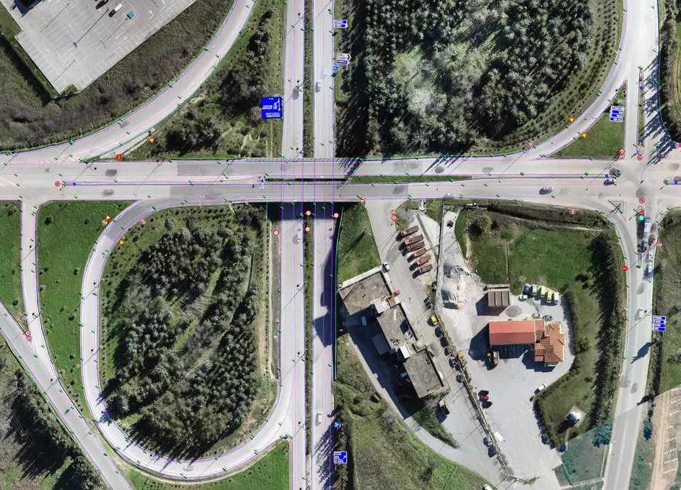
Matrice 400 with the L2 LiDAR or the P1 camera, ground control points with GNSS RTK via HEPOS (the Greek GNSS reference network), a total station for the road structures.
In MAPS Atlas
Automatic ground classification, DTM with breaklines, road markings from the LiDAR intensity, orthophoto, longitudinal profile and alignment.
We deliver
Plan view, longitudinal and cross sections, DTM, orthophoto map, road markings in DXF.
Drone LiDAR, which “sees” the ground through dense vegetation, and GNSS for the check points.
In MAPS Atlas
Ground extracted by three algorithms that vote, a 0.5 m DTM, profiles and sections straight from the model, and the Cadastre, forest maps and Natura areas on the same map.
We deliver
Stream demarcation survey plan, cross sections, DTM for the hydraulic study.
Low-altitude drone photogrammetry for detail, LiDAR where there is vegetation, GNSS for the ground control points.
In MAPS Atlas
Orthophoto from the point cloud, building outlines, contour lines, and on top of them the Cadastre, town plans and old drawings georeferenced to GGRS87.
We deliver
Orthophoto maps, base maps for urban planning studies, topographic survey plans.
A FARO scanner for the details, a drone and a camera for the whole site, a geodetic control network for accuracy.
In MAPS Atlas
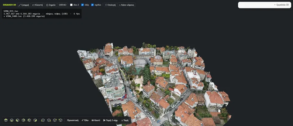
Many point clouds together in 3D, each in its own system, with a deviation below 1 mm. Sections, elevations and plans across all the point clouds at once.
We deliver
Elevations, sections and plans for the restoration study, a 3D model.
GNSS RTK and a total station for the boundaries, with traverse and network adjustment in the office.
In MAPS Atlas
Land distribution plans (διανομές), land consolidations (αναδασμοί) and old survey plans georeferenced to GGRS87, Cadastre land parcels downloaded as DXF, conversions from old coordinate systems.
We deliver
Topographic survey plans, comparisons with title deeds and the Cadastre, Cadastre correction dossiers.
Inside MAPS Atlas
One environment for all the work of the office, constantly improved with the team's suggestions.
Towns and buildings
Scanner and drone in one cloud
The FARO cloud and the drone cloud of the Bema of the Apostle Paul in Veria, together in 3D.
Monuments
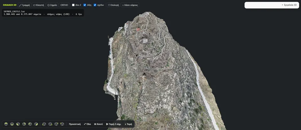
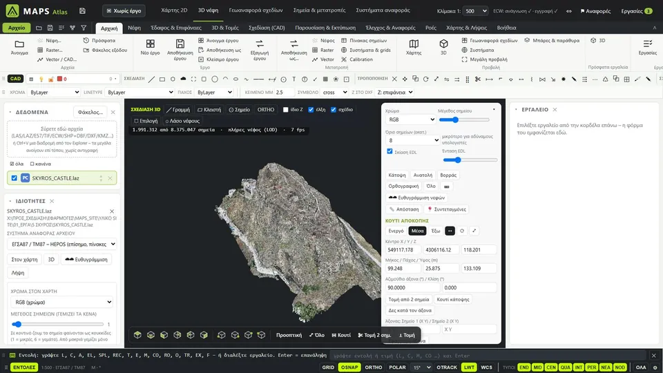
Skyros Castle in 3D
Millions of points in true colour, sections and elevations from any side needed.
Speed
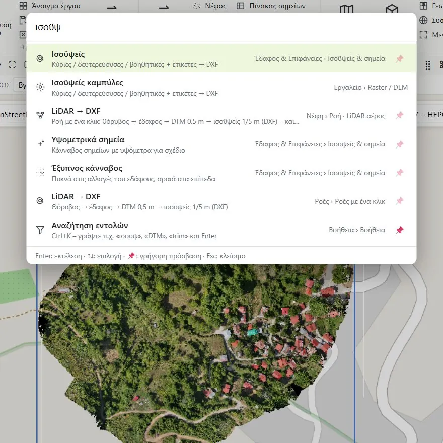
Every tool with Ctrl+K
Find any command with one word, run workflows with one click and apply the same task to every file in a folder.
Drafting
Drafting like in AutoCAD
We draw on the point cloud and the map, with layers, snaps, COGO, long sections, setting out and scaled printing.
MAPS Atlas is an in-house tool of our team and is not for sale. We use it on every project we take on.
Do you have a project that needs surveying and processing?
Tell us what you need. We will propose method, deliverables and cost.